Category Archives: Archaeology

Sustainable archaeological survey: lessons from Armenia, 2019

This summer’s research had three goals:

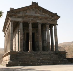
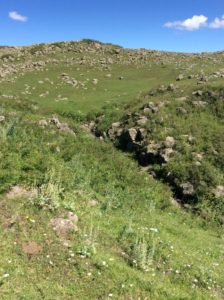
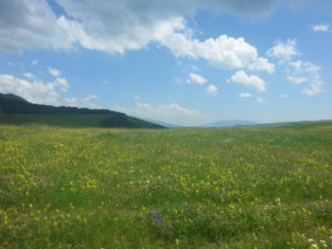
  1. to begun to understand the relationship and route between the ancient sites of Garni and Artashat;
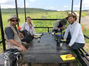
  2. to train colleagues on GIS; and
  3. to test an entirely digital workflow that utilized open-source software and inexpensive hardware, in order to think through a system that would be sustainable for archaeologists of fewer resources.

This post will focus on #3, primarily because the work on 1 and 2 is ongoing. I made progress on each of goals 1 and 2, but there is still work to be done.

The third goal, a sustainable digital workflow, was important to me for a variety of reasons. First, as archaeology turns to productive and useful technology like LIDAR, drones, magnetometry, GPR, and even GIS like Esri’s ArcGIS, archaeology is becoming a discipline so expensive that organizations like the Institute of Archaeology and Ethnography in Yerevan really almost rely upon international collaboration to access such technologies. In addition, as scholars in the U.S. – like me – come to be employed in contingent positions or teaching positions with little research support, such expensive technologies are difficult for us to access, as well.

Open-source software is an excellent solution to at least some of the problems of lesser-resourced research institutions and people. I also have a firm belief in the importance of scientific communication and datasharing, and I think that the social scientific community ought to consider adopting the principles behind open-source software. In addition to the sustainability of open-source software, the digital aspect of the sustainable digital workflow is also important because of its potential for creating datasets capable of multivocal interpretation.

The good news is that I achieved goal 3, but like all workflows and scientific tools, there are trade-offs to consider.

Continue reading

Armenia in the ether

An email from a journalist inquiring about the Garni Temple pointed me to an interesting project: My Armenia, a collaboration between the Smithsonian Institution, USAID, and Armenia itself. The project seeks to document the cultural heritage of Armenia. The Smithsonian’s website  has also increased the attention it pays to the country, running articles on the Garni Temple, as well as on issues of the biology and geography of Armenia.

IMG_4489 - Copy

The Garni Temple. Photo by E. Fagan.

ASOR 2016, and our *online community* is up and running!

We had a great “Archaeology of the Black Sea and Caucasus” session this year at ASOR, with excellent talks from Tiffany Earley-Spadoni, Nat Erb-Satullo, Walter Crist, and Hannah Chazin. We also announced the opening of our online forum, generously supported by the American Research Institute of the South Caucasus.

To join the conversation, please follow the instructions here: South Caucasus Forum Registration.

Coming down the mountain (everybody has their own opinion)

Groundtruthing, or checking out on the ground anomalies and architecture seen in the satellite imagery, is a necessary step in identifying cultural remains. We went high on the slopes of Mt. Aragats yesterday, to take a look at a site that looked like a settlement with some recent activity. Amongst the architecture, we found a fascinating series of stacked and standing stones picking out a roughly north-south line across the summits of multiple slopes.

IMG_1176 2
IMG_1172

However, we were already high up on the flank of the mountain, high enough that the “scree” drainages in this photo are actually made of boulders — and high enough that the cloud obscuring the summit was worrisome.

IMG_1170 2 Continue reading

Survey says…

One way to conduct an archaeological survey is to examine satellite imagery as a way to focus attention on particular areas. This summer, the Kasakh Valley Archaeological Survey looked at high resolution satellite images of the area east of Mt. Aragats and identified a number of intriguing sites.

Med settlement 2

In this case, I found a series of rooms that seem to be enclosed by a wall, to the south of the shallow gorge in the upper third of this image. We established that it was within our survey area and the next morning, off we went to take a look. After a first attempt to drive there in our UAZ, we circled around from the north and hiked in across the gorge.

IMG_0165

This is looking northwest from the settlement, across the gorge–which was not very deep, and the rivulet at the bottom, like many water courses in Armenia, had many conveniently-placed stones useful for crossing. Continue reading

Survey in the upper Kasakh River valley

Project ArAGATS, the joint Armenian-American project on the Archaeology and Geography of Ancient Transcaucasian Societies, has begun surveying the Kasakh River valley in central Armenia over the past couple of years. We’re recording burials, burial clusters, settlements, fortresses, stelae, evidence of Soviet-era land amelioration practices, and more. This year, we’re working around the northeastern foothills of Mt. Aragats, to continue the project of understanding the relationship of ancient architecture and material culture to ancient life.

20160701_052109

Ian Lindsay and Alan Greene are co-directing the survey this year, with multiple team members from Project ArAGATS, including Salpi Bocchieriyan, and Karen Azatyan, pictured here with Ian and Alan on a well-deserved coffee break after a morning of tromping around the mountains.


IMG_0007

To keep up with the excitement of counting sherds and obsidian flakes, or other aspects of Project ArAGATS’ multiple projects, follow @egafagan and @aragatsfound on Twitter.

Building a community of scholarship

One of the best things about the twenty-first century has to be how our ability to research and keep in touch with colleagues has changed dramatically. I’ve been trying to do my part to help build community amongst scholars who study the South Caucasus. As one project meant to work on this goal, I co-chair an annual session on the archaeology of the Black Sea and Caucasus regions, at the ASOR annual meeting. At the 2015 meeting, we crowdsourced ideas for an online community, and so I’ve built a forum on this website as a beta test, before going live on the American Research Institutes of the South Caucasus site, where the forum will eventually be housed.

More on crowdfunding science from Science Friday

I had the most useful laundry day ever. Spacing out, folding t-shirts, and suddenly Science Friday’s discussion reaches my active brain through the laundry daze – they’re talking about crowdfunding science projects! The interviewee started a website, experiment.com, where scientists can appeal to funders for their projects. Some of the projects are ridiculous (“does potato salad taste good” earned its PI $104!), but the choices also include many interesting-looking social science projects. While I wonder about a crowdfunding bubble, the possibilities seem boundless right now, and especially important when governmental funding is in danger.

AJA cover – again!

The Project ArAGATS crew must have very photogenic trenches – we are on the cover of the American Journal of Archaeology for the second time in 2014. Last time, it was for a trench I excavated in 2011 at Tsaghkahovit, in the Iron Age complex. This time, it is a photo of a shrine area, one of many excavated at Gegharot, an Early and Late Bronze Age fortress on the flanks of the Pambak Mountains bounding the Tsaghkahovit Plain. Project ArAGATS has been working in Armenia since 1998, making it one of the longest-running collaborative projects still working in Armenia.

American Journal of Archaeology Vol. 118, No. 4 (October 2014)